Red Line Project
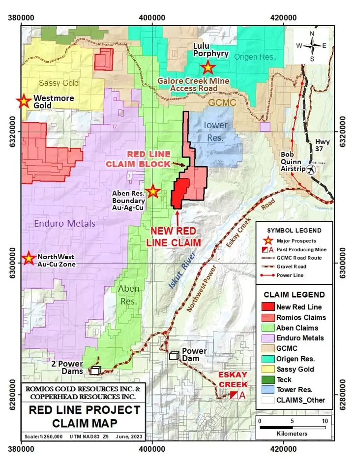
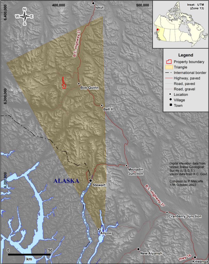
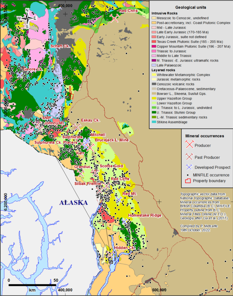
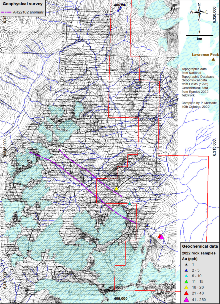
The Red Line Project is an early-stage exploration project consisting of 10 claims covering over 3,989 hectares and is located in the central part of the “Golden Triangle” mineralized district of NW British Columbia. It is situated along the “Eskay Rift” belt of rocks that host the Eskay Creek Au-Ag deposit 30 km to the south.
Exploration Highlights
Discovery of Key Intrusions: Three highly prospective intrusions identified on the Red Line Project, including two K-feldspar porphyritic syenite areas similar to those at the Galore Creek deposit.
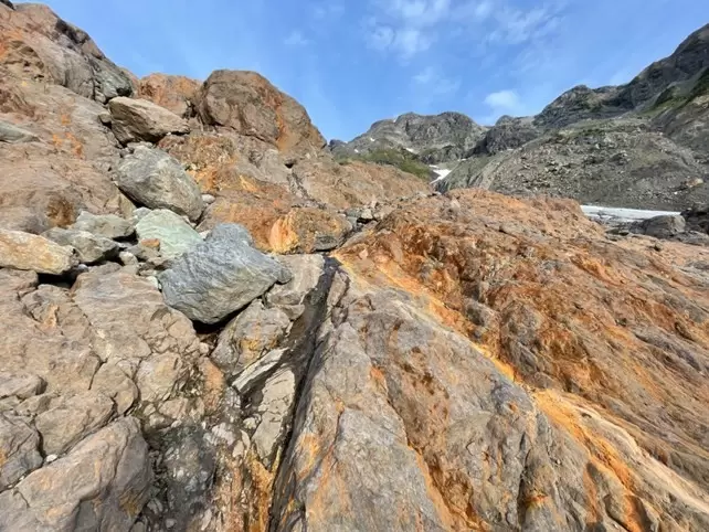
Newly Staked Pluton: A significant K-feldspar porphyritic syenite pluton, over 300 meters wide, discovered and staked south of the Red Line claims, showing strong gossanous features indicative of potential porphyry copper-gold systems.
Syenite Dike Swarm: Multiple K-feldspar syenite boulders and widespread epidote alteration on the Red Line 2 claim suggest a possible porphyry system at depth.
Hornblende Granodiorite Pluton: A previously unknown, 700-meter-long hornblende granodiorite pluton discovered on the Red Line 2 and 3 claims, with significant alteration and pyrite presence.
Geology
The Project is situated across Downpour Creek Valley between Lawrence Peak and Faisal Peak, with the Forrest Kerr fault running north-south west of Faisal Peak. This fault separates Palæozoic rocks to the west from Upper Triassic to Middle Jurassic rocks to the east. East of the Project, the geology transitions from Middle Jurassic siliciclastic rocks through Lower Jurassic volcaniclastic rocks to Upper Triassic strata. The Project area features Upper Hazelton Group sedimentary rocks, with a preserved sequence from the Toarcian through the Lower Bathonian, similar to the host rocks at Eskay Creek.
Deposit Types
The area defined by the Golden Triangle is host to more than 1000 mineral deposits identified in MINFILE. More than 700 are gold-bearing. Of these, more than 10% have not been assigned a British Columbia Mineral Deposit Profile. Fully two thirds of the remainder are identified as “veins” albeit a large number of these are identified as “intrusion-related”. The balance of mineral occurrences range in inferred deposit type from porphyry through vein and epithermal to near-surface types; these last, for convenience, will be grouped as “exhalative” or “hot spring deposits”.
Access
Paved Highway 37 extends north from its junction with Highway 16 near Kitwanga to the Alaska Highway in the Yukon Territory. Stewart, accessible via Highway 37A, is 205 km from Bob Quinn. Both highways are upgraded and handle heavy traffic from the Red Chris Mine. Two gravel roads, built for heavy traffic, leave the highway 3 km south and 8 km north of the airstrip.
Ownership
On April 6, 2022, Copperhead entered into an option agreement with Romios Gold Resources Inc. Copperhead has the option to acquire 75% of Romios’ interest in the Red Line Project. The Company can exercise the option to acquire 75% of the Project by:
- Incurring exploration expenditures of
- $75,000 by April 6, 2023 (Met);
- $100,000 by April 6, 2024 (Met);
- $150,000 by April 6, 2025;
- Issuing:
- 1,000,000 common shares to Romios by April 11, 2022 (Issued);
- 500,000 common shares to Romios by April 6, 2025;
Making a cash payment of $75,000 by April 6, 2025; and
Enter into a joint venture with Romios to collectively operate the Project, whereby the Company’s initial interest in the joint venture shall be 75% and Romios’s initial interest shall be 25%.
